This round is also popular with bikers, given that the three elements of the route are all official bridleways.
If done clockwise, the first part is a normal ascent of Snowdon on the Llanberis Path.
The second part is a descent on the Snowdon Ranger Path to within nearly a mile of the bottom of this path, where a signed path leads off up to Bwlch Maesgwm.
The last part is along Maesgwm, a good route colloquially known to some as Telegraph Valley (there used to be telegraph poles along this route).
 The Maesgwm turning on the Snowdon Ranger Path – it’s well signposted
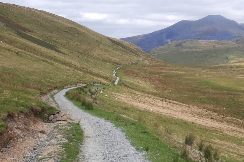 The path from Bwlch Maesgwm back down towards Llanberis
The round as shown below measures 10½ miles.
The round can, of course, be undertaken in a reverse direction to that described.
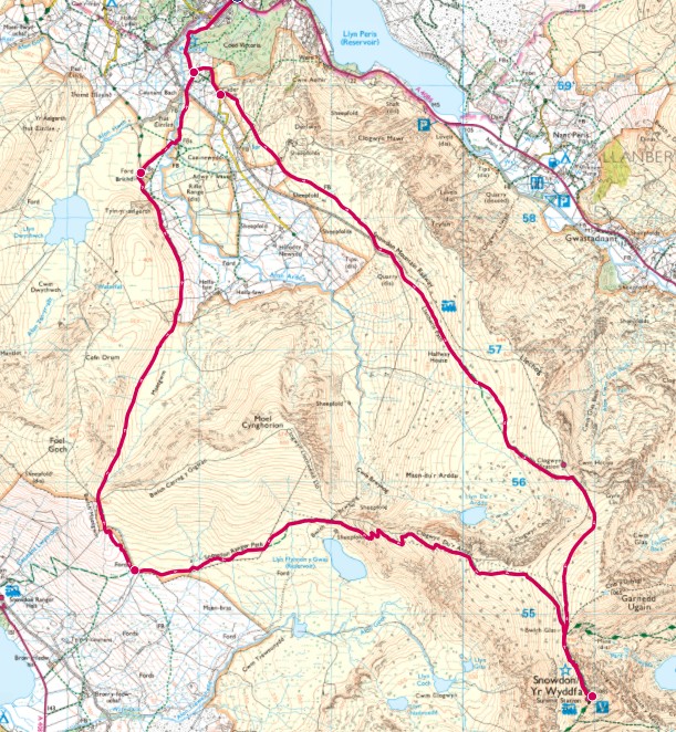 Ordnance Survey data © Crown copyright and database right 2025
The second map below shows a detailed view of the bottom of the Llanberis and Maesgwm paths. The Right of Way linking the two has recently been upgraded (shown by the red line), so that you can link right back to the bottom of the Llanberis Path.
The red dots indicate the bottom of the Llanberis Path and the Maesgwm Bridleways where they meet tarmacked lanes.
Note that the section linking Maesgwm with the Llanberis Path (the red line below) is not a bridleway, so bikes are not permitted. If you are on a bike you will need to continue on the Maesgwm Bridleway until you reach the tarmac, then descend to Llanberis.
 Ordnance Survey data © Crown copyright and database right 2025